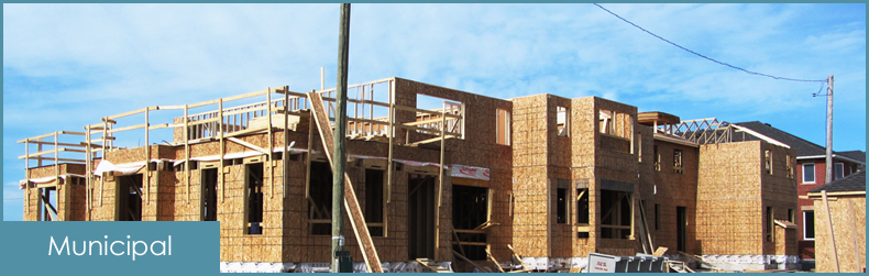
Municipal Survey Services
If you’re building a new home, renovating an old one, retracing existing boundary lines or starting fresh on a new subdivision, we have the staff, technology, and expertise in all areas of municipal development.
Real Property Report
Real Property ReportThis report defines buildings (also includes other types of structure “of a permanent nature”) that are on your land. It is a legal document that includes a plan or survey that illustrates the location as well as our notes regarding the structures and property lines.
Property Line Surveys
Where exactly does your property begin and end? We will accurately locate your boundary and physically mark the boundary on the ground.
Development Permits
Development PermitLooking to build on your property? Development permits are required for many types of projects, and vary by municipality and location. If you’re unsure whether you’ll need a development permit survey for your project, it’s always best to check with your municipality first. Once your needs are determined we can complete the necessary surveying for you.
New Home Surveys
New Home SurveyA new home survey is required for all new home and commercial construction. We will accurately locate your structure, both horizontally and vertically on the subject parcel. We can then work with excavation and cribbing contractors to get your project started correctly.
Grading Certificates
Grading CertificateThe City of Calgary and most surrounding municipalities have their own lot drainage bylaws in place. We have extensive experience in collecting data and producing the necessary documentation to ensure compliance with each municipality’s bylaw.
Subdivision Surveys
We can provide all the necessary expertise and services to take any land development project from start to finish.
Condominium Surveys
There are different options available when considering a condominium project of any kind. We can advise you on your options, help determine the best solution for your development, and see the project through to completion.
Earthwork & Quantity Surveys
We can provide surveys to measure accurate quantities and volumes.
Topographic Surveys
Defining the contours of the land to precisely determine grading and slope, is an essential initial step, for almost any type of project. We use the latest technology to determine the topography of your land to the highest accuracy specifications.